Geography of Norway
Norway is a beautiful country in Northern Europe known for its unique shape. It is a long, narrow, skinny land with a very rocky coastline. One of the most famous parts of Norway's geography is the fjords. These are deep, narrow inlets of water with high cliffs on both sides. Norway also has many tall, snow capped mountains and thick forests. Because it is so far north, some areas are covered in ice and glaciers. The weather can be very cold, especially in the winter. From its deep blue water to its high mountain peaks, Norway has amazing natural scenery.
Most Seen Geographical Features
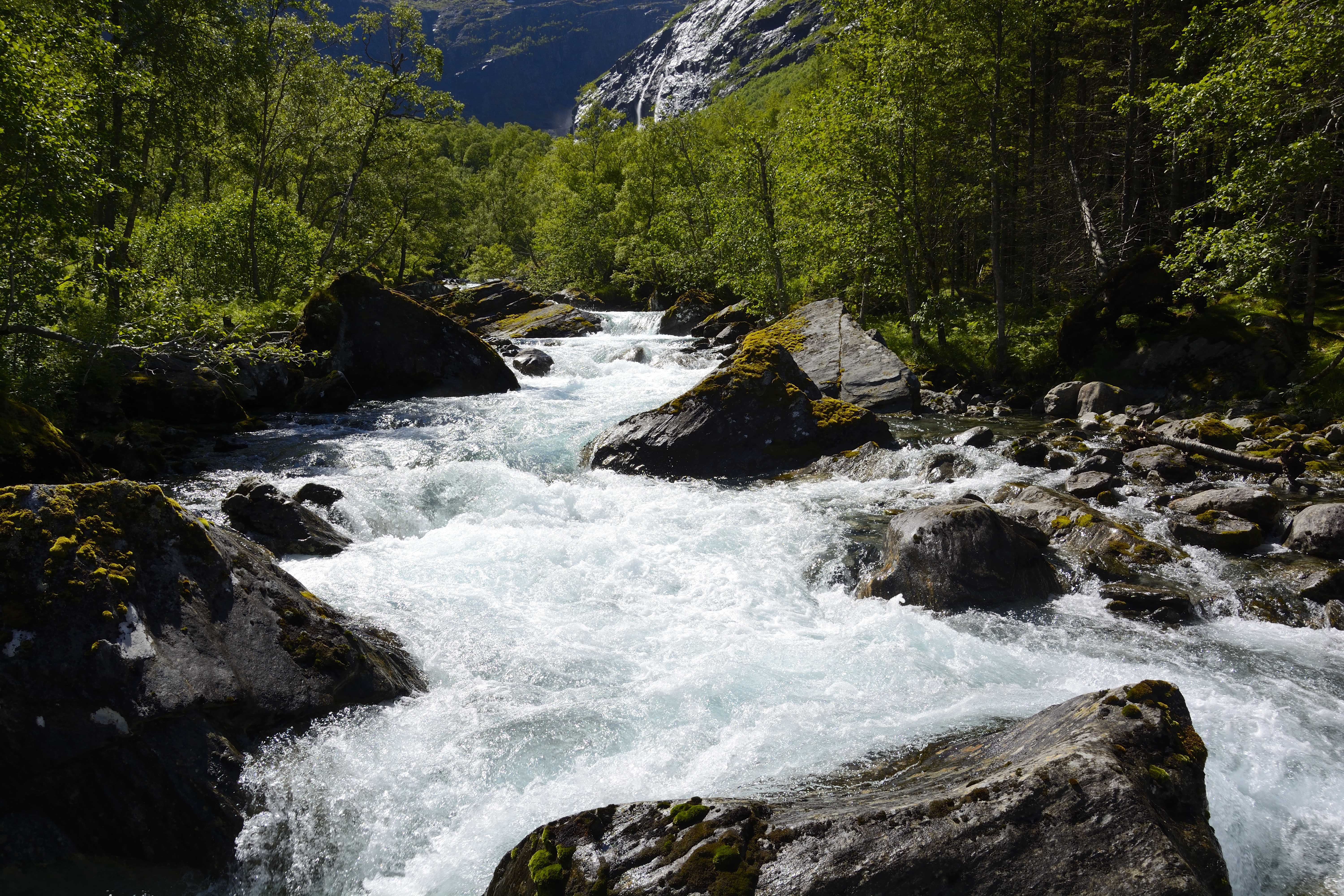
Norway's land looks the way it does because of huge sheets of ice called glaciers that covered the area a long time ago. As these heavy glaciers moved, they acted like giant sandpaper, grinding down mountains and carving out deep, U shaped valleys. When the ice finally melted, the ocean flowed into these deep valleys, creating the famous fjords we see today. Because of all this carving and scratching by the ice, Norway has a very wiggly coastline with over 300,000 islands and some of the steepest mountain cliffs in the world. We go over more of the Fjords and their names in our webpage all about Fjords!
- Geirangerfjord
- Geirangerfjord is a giant, spectacular valley in Norway that was carved out by massive glaciers thousands of years ago. It is famous for its deep blue water and incredible waterfalls, like the Seven Sisters, that crash down from cliffs nearly a mile high. Because this place is so unique and beautiful, it is protected as a World Heritage site so people can visit and enjoy it forever.
- Hardangervidda
- Hardangervidda is the largest high-mountain plateau in Europe and Norway's biggest national park. It is a vast, treeless wilderness where you can find the continent's largest herds of wild reindeer. People visit this beautiful area to hike between mountain cabins in the summer or go cross-country skiing across the snow in the winter.
- Nigardsbreen
- Nigardsbreen is a famous part of the Jostedalsbreen ice cap, which is the largest glacier in mainland Europe. It is well-known for its bright blue ice and is very easy for visitors to reach by taking a short boat ride across a nearby lake. Because glaciers can be dangerous with deep cracks called crevasses, travelers must always explore the ice with a professional guide to stay safe.
- Galdhøpiggen
- Galdhøpiggen is the highest mountain in Norway and all of Northern Europe, standing at 2,469 meters tall. Most hikers start their journey at a mountain cabin called Juvasshytta, where they must join a guided group to safely cross a glacier. Once you reach the top, you can see amazing views of snowy peaks and deep valleys stretching out for miles in every direction.
- Glomma
- The Glomma is the longest river in Norway, stretching over 370 miles from the mountains to the sea. It is very important because it uses rushing water to create electricity for many homes and businesses across the country. People also enjoy using the river for fun activities like fishing and boating during the warmer months.